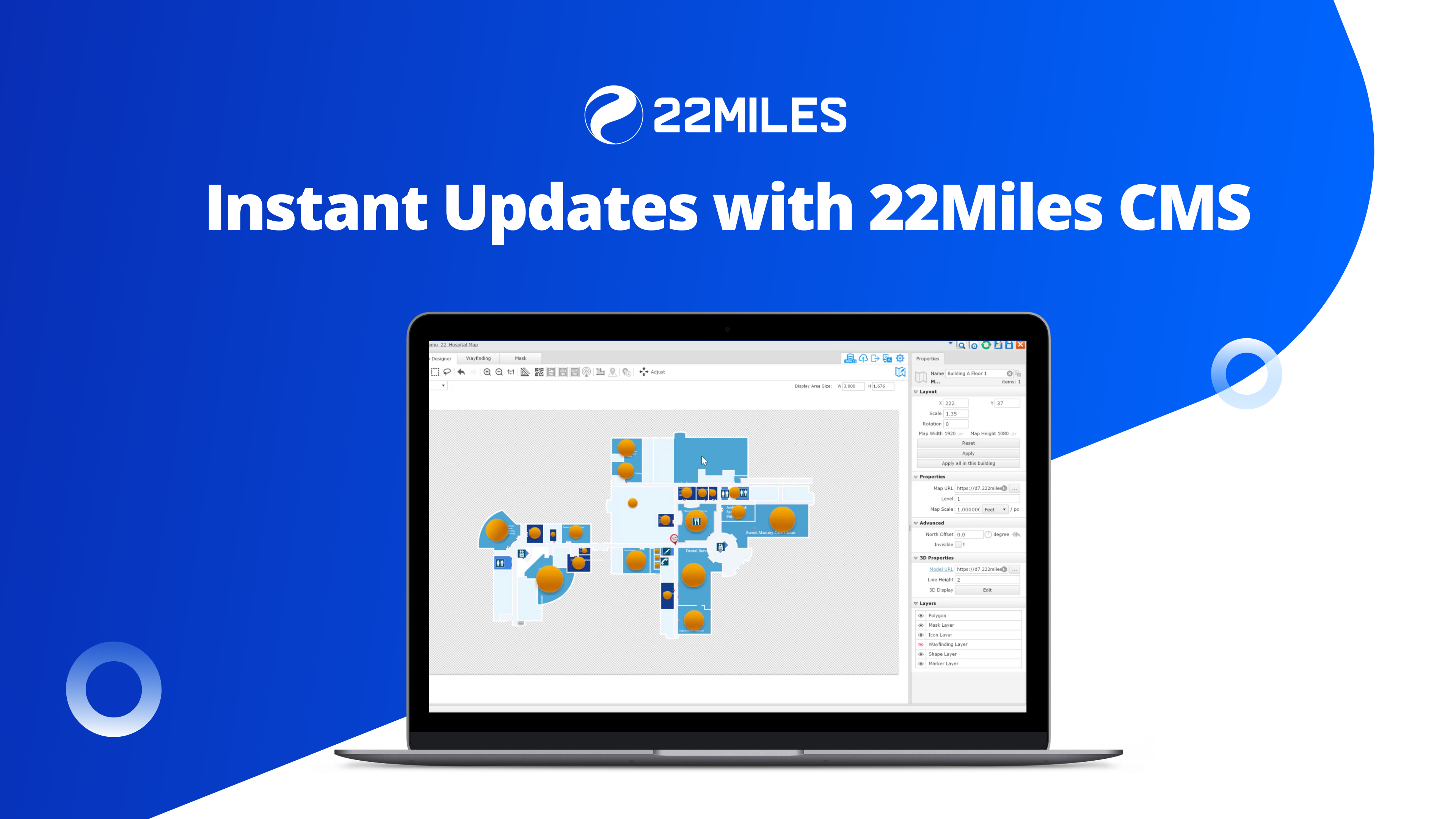
3D Wayfinding

22Miles 3D Wayfinding platform not only provides wayfinding for customer venues but also information and concierge as a total solution.

A map designer built to accomplish your unique requirements

Usability

Workflow

Functionality

Data

Map Designer & Editor Tool

22Miles’ Map module is used to simplify your mapping projects to build, import 3D models, edit rooms and nodes and manage routes. Manage and edit your custom maps built by the 22Miles team or drag and drop your PNG and SVG floor plans. Property settings and pick-and-click controls provide a powerful Map Design tool with ease of use with 3D layers and editable floor plans. Built-in catalog that is easily editable and allows for import/export listings. Leverage the same map content and publish to mobile apps with one click.

3D Furniture and Fixture

Supported in kiosks, native iOS/Android apps, and SDK plug-in, 3D objects such as desks, chairs, stairs, and other assets can be leveraged for a more immersive wayfinding experience. The solution can create a wow-factor in a virtual environment that replicates the physical space for better orientation and association.

Augmented Reality and Beacons

Users can detect indoor location in real-time using Bluetooth Low Energy (BLE) Beacons, geomagnetic positioning, or our proprietary AR image recognition technology. Our SDK gathers proximity insights and dwell time data so you can best guide your visitors’ mobile experience. Provide a real-world guide to unfamiliar environments with augmented reality. Display routing, distance and time estimates, promotional content, and more as a camera view overlay.

22Miles Map Foundation

Structure 1

Map Editor
Structure 2

Players

Map Automation/Import

– Create and manage Wayfinding Pathways using our unique Wayfinding Tool.
– Drop Nodes (Wayfinding Points) along all navigation routes.
– Connect the nodes to create point A-B interactive pathways. The system leverages the propitiatory 22Miles map engine with a smart pathway algorithm.
– Control traffic with one-way navigation settings.
– Scheduled events, detours, route closings of elevators, stairs, etc., whenever needed.
– Manage wheelchair routes and accessibility options for – ADA compliance to ease everyone with the same wayfinding experience.

Map Data Management

Button Clicks

IOS / Android Installation Daily

Wayfidning

Media Playback

Wayfinding / Button Clicks

Secure Mobile Control

Space Booking

Mapit / Locate

AR Management

– 22Miles AR brings a new immersive experience to an existing environment. Creating an engaging, real-time wayfinding adventure.
– 22Miles provides different image recognition options for end-users in a mobile project. It intuitively improves the accuracy over time.
– AR image recognition locates the user’s current position on the mobile project map and any surrounding relevant images, icons, or text.
– AR Billboard will display a virtual billboard on the app when the end-user arrives at a location.

Positioning Management

– 22Miles provides the capability to integrate with third-party beacons/Bluetooth positioning services such as Cisco DNA, Zebra, Gimbal, HP Aruba, etc.
– 22Miles mobile app automatically tracks a user’s current location and reflects on the mobile map. All wayfinding will start from the current location and without the need to select a starting point manually.
– All location data is calculated with the help of a third-party positioning server and integrated with the coordinates in the 22Miles map through an X/Y Source.

IMDF

22Miles has natively built in the support for IMDF Map Export. Indoor Mapping Data Format provides a generalized, yet comprehensive model for any indoor location, providing a basis for orientation, navigation, and discovery. IMDF maps integrated with indoor positioning can establish the foundation for a wide range of consumer and enterprise location-based apps and websites.

SDK & API

22Miles’ mobile web app, open API, and iOS/Android SDKs have been built to enable all wayfinding experiences as native to plug-in enabled options. Regardless of the solutions or vertical market, our player structure comprises a wide variety of components and features required to integrate mapping into a website, mobile application, kiosk, or directory. Used to create our own pre-built applications, we have the documentation and support to allow you to DIY your own experience or plug it into an existing application. Augmented Reality SDK Plug-in and AR image recognition have also been developed for ease of use to drive an innovative experience to any environment.

3D Wayfinding Feature
List Sheet